
Turn drone flights into actionable site data
Process and overlay flight data with site designs and as-builts to calculate volumes, verify material placement and coordinate field operations — all from Trimble WorksManager software.
Know what's happening on the jobsite
Know what's happening on the jobsite
Trimble WorksManager Drone simplifies drone data processing in the Trimble ecosystem you already rely on. Compare flights against designs, as-builts and third-party data to enable stakeholders to track and measure site progress.

WorksManager Drone
"Now we can quickly process flight data, putting 3D visuals and cut-fill site metrics right in the hands of our foremen and project managers. Bringing that real-time visibility to the field gives us the clarity to make immediate, informed design changes and site decisions."
Joe Zapien | Field technology manager at Markham Contracting.
Get a complete, accurate picture of the jobsite
Accuracy
Achieve survey-grade ground control point accuracy through Trimble Siteworks GCP sync and Trimble RTK GNSS drone support with corrections.

Collaboration
Access a 3D collaborative view including layered designs, terrain models and drone data.

Validation
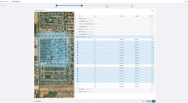
Reduce processing errors by auto-validating data and addressing image gaps before processing with a four-step processing wizard.

Processing options
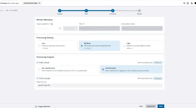
Select low-, medium- or high-resolution processing based on job requirements and turnaround times.

Compatibility
High-accuracy data processing is available for major hardware vendors with support for professional survey drone platforms and standard imagery formats.

Support
Count on timely support from Trimble dealers.


Info sheet – Trimble WorksManager Drone

Info sheet — Trimble Worksmanager software

Brochure — Site management software portfolio
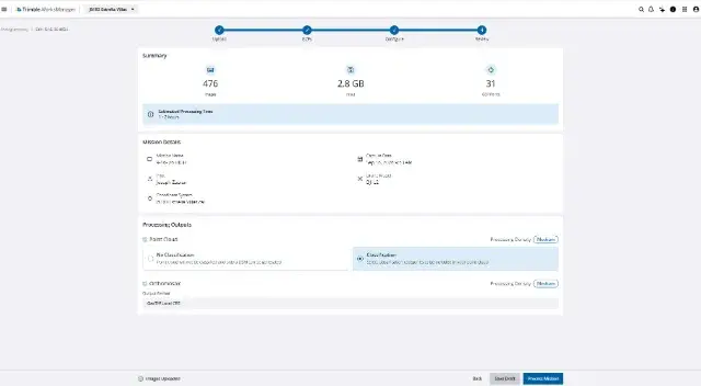
Drone data processing in four simple steps
Verify mission specifications, configure output settings and trigger raw dataset processing, all with the simple four-step wizard:
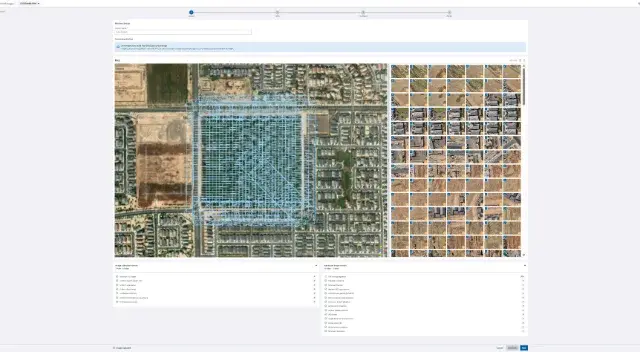
Step 1 - Setup and upload
Integrates with
Trimble WorksManager
Instantly send construction-ready models to machines in the field to make sure crews are always working to the latest designs.
Trimble Siteworks
Trimble Siteworks positioning systems are designed to eliminate downtime by making every minute more productive. Handle complex files and 3D data sets quickly, so you can spot issues and solve problems before they slow you down.
Trimble Connect
Collaborate effectively and efficiently with a single source of truth for all data generated during the lifecycle of a construction project.
Trimble Business Center
Make better decisions, decrease costly mistakes and increase efficiency in the office and on the job site. Powerful tools help you quickly and easily create accurate, integrated 3D constructible models for construction surveying and machine control.
Trimble Earthworks grade control
Trimble Earthworks provides precise machine control that reduces rework by helping operators get it right the first time, regardless of their skill level.
Trimble WorksOS
Accurately monitor jobsite activity and real-time progress-to-plan, remotely, with information straight from the machine.
On-machine GNSS systems
Maximize accuracy and equipment uptime with rugged smart antennas and modular GNSS receivers built for heavy machinery.
GNSS systems for surveying and positioning
Trimble offers a range of integrated and modular GNSS systems to suit your specific application, signal tracking and budget requirements.